Select Page

How Exactly to Get From Tuxedo Station to R-D Trailhead (with map and pictures)

Pictures to show you exactly how to get from Tuxedo Train (rail) Station to the start of the Ramapo-Dunderberg Trail.

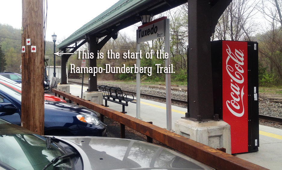
So we are pulling into Tuxedo Station.  We’re about to spend two (or maybe three) days hiking the length of the famed, fabled Ramapo-Dunderberg Trail.  It’s historic.  It’s beautiful.  It’s total escape.  It’s one of the quiet claims to fame of the tiny town of Tuxedo, New York.

Now where is it?

Here’s the map:

Map describing how to get from Tuxedo train station to start of the Ramapo-Dunderberg trail in Harriman State Park, New York. Follow the pink dotted line from the Tuxedo train station north, then across the bridge on East Village road, and then into a residential neighborhood. Look for the red-on-white blazes of the Ramapo Dunderberg trail, nailed to a tree.

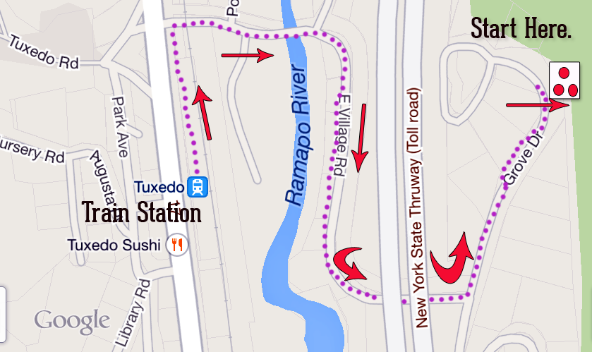
Believe it or not, this wonderful trail — one of the top hiking trails in the Northeast, and certainly popular among New York City’s outdoor enthusiasts — begins without fanfare, in the parking lot, a few feet from the Metro-North platform.

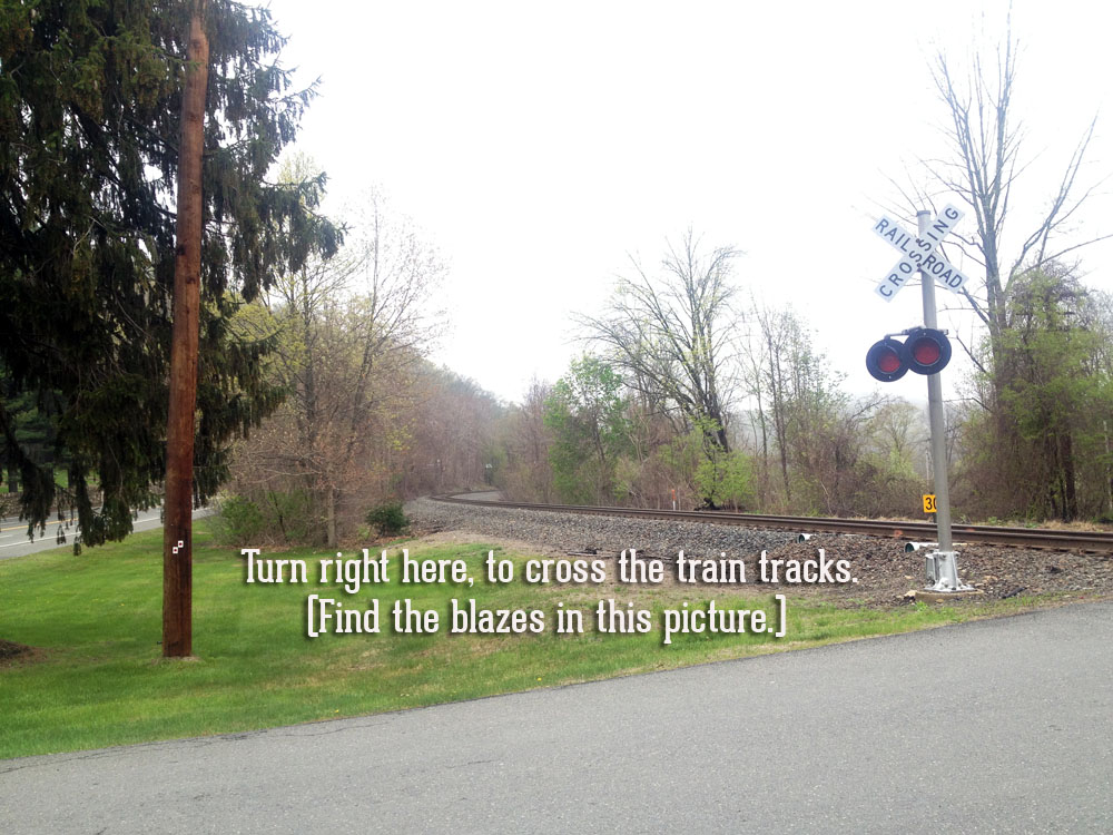
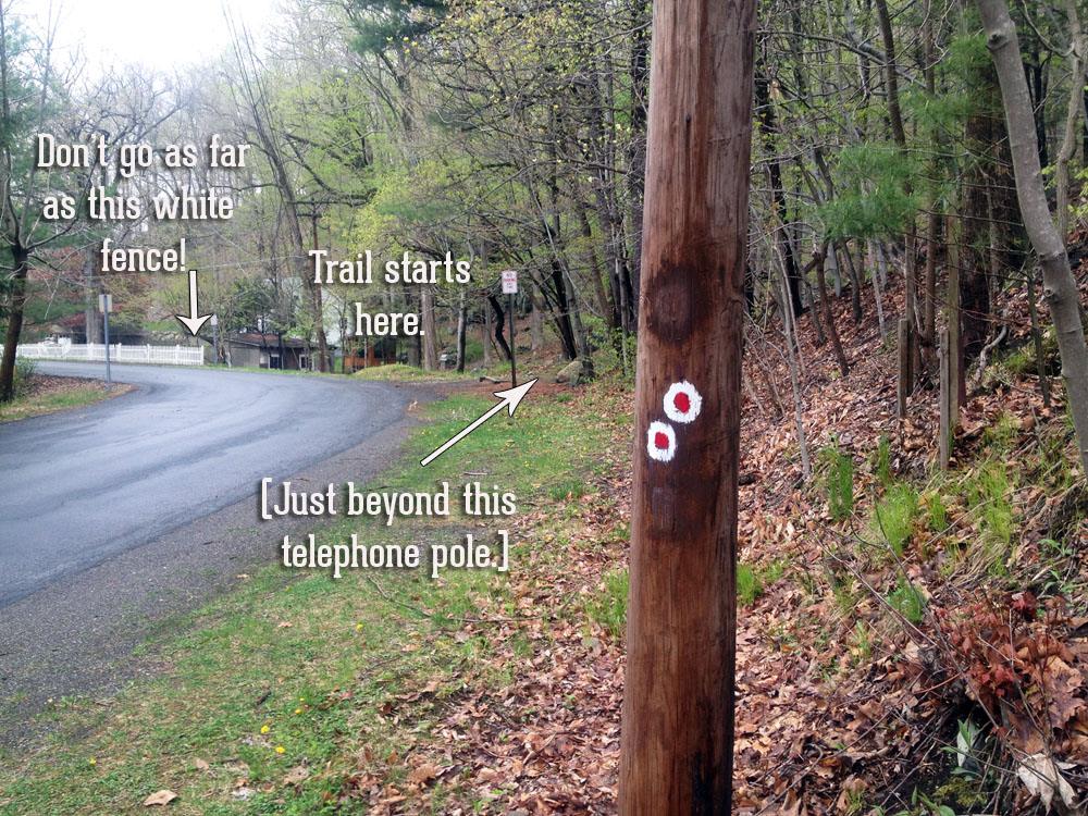
The entry blazes are on a utility pole, between parked cars.  See them?

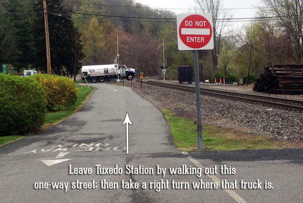
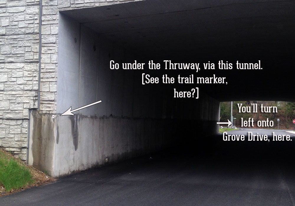
The following are pictures to guide you.  But: Do use the map, above, to get from the Tuxedo Train station to the start of the R-D trail.

The start of the Ramapo-Dunderberg trail in Harriman State Park, begins in the parking lot of Tuxedo train station.

The start of Harriman State Park's Ramapo Dunderberg Trail, which leaves the parking lot of Tuxedo Train station and crosses the railroad tracks.

The right-hand turn onto East Village Road in Tuxedo, New York.  Follow the red blazes.

ramapo_dunderberg_grove_drive_underpass_tuxedo

trailhead_ramapo_dunderberg_grove_drive_tuxedo

Print Friendly, PDF & Email