Bald Rocks shelter, approached from the south, and the Ramapo-Dunderberg Trail in Harriman State Park. The lean-to is easy to get to, and offers easy overnight parking in a pull-out lot on Route 106.
Two of Harriman State Park’s beautiful lean-to shelters — Bald Rocks and Tom Jones — can be accessed from the parking area on Route 106, at GPS location 41.23038 N, 74.13996W.
In this parking area — a pull-out on the north side of the highway — overnight parking is permitted. You don’t have to register, sign in, make a reservation, or leave a note on your dashboard. Just park, and go.
From this off-road pull-out, you can leave your car and take the red-blazed Ramapo-Dunderberg trail either north or south to reach the shelters.
Download the PDF trail map for Tom Jones shelter and Bald Rocks Shelter, Harriman State Park
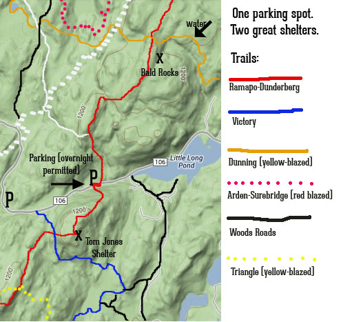
Two shelters, one parking lot. Access to Tom Jones lean-to and Bald Rocks lean-to is easy, from the pull-out lot on Route 106 in Harriman State Park. Use the link below to download a PDF of these trails. White trails shown above are the White Bar trail (broken white line), and the Nurian trail (solid white).
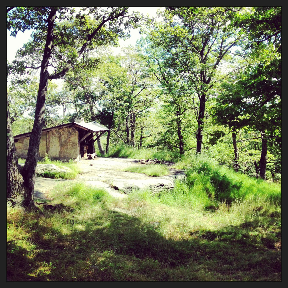
Bald Rocks Shelter
If you go north (staying on the same side of the road as the car park), stay on this fine stretch of red-blazed trail until you reach Bald Rocks shelter, at about 1.5 miles from your car.
From the parking pull-out, look for the blazes to start just east of the lot — they’re a little hard to spot at first, but they traverse some rocks and boulders over a boggy little patch that parallels the road, before turning north, up the hill.
At Bald Rocks, you’ll find a fire ring and fireplace inside the shelter. There’s a stream not far from the shelter that’s reached by hiking on the yellow-blazed Dunning Trail that leaves the red-blazed trail to the right, just past the shelter. Follow it for about 1/4 mile downhill to reach the stream.
You’ll also find plenty of grassy areas and other fire rings, should you prefer to set up a tent on the grass, or throw up a hammock.
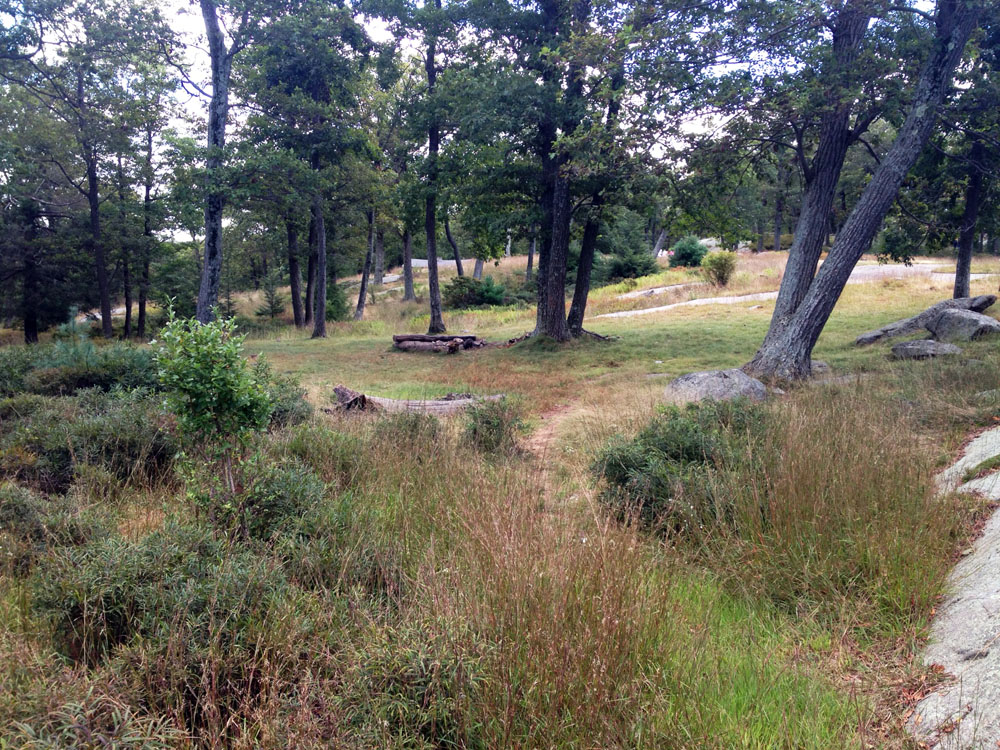
The areas surrounding Bald Rocks shelter in Harriman State Park is a grassy, mostly-level open area, with plenty of fire rings and places to pitch a tent or tie a hammock. See thedownloadable PDF map for the two shelters, and the trails, below.
Tom Jones Shelter
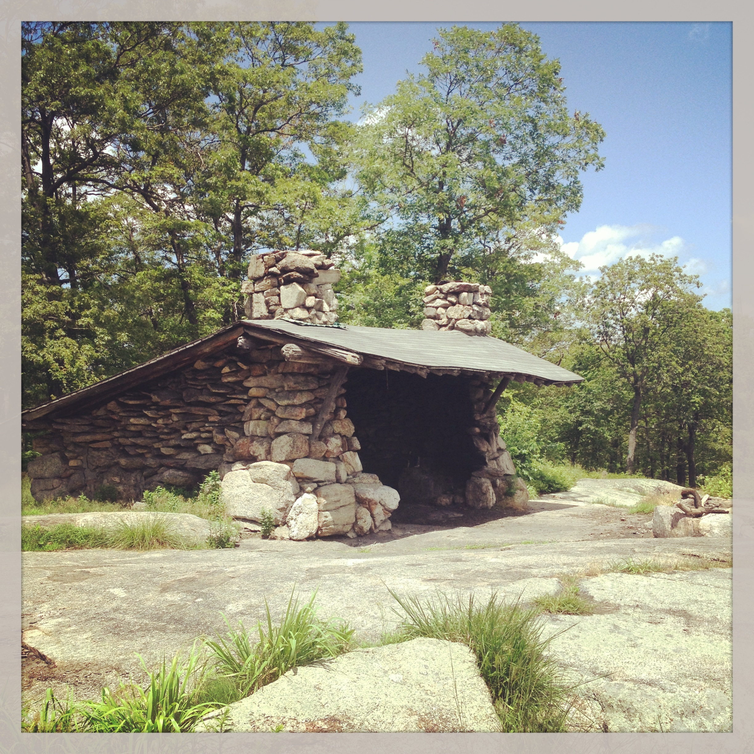
Tom Jones Shelter leanto, Harriman State Park
You can also make the short hike uphill to Tom Jones shelter, by crossing Route 106 from your car and following the red-blazed Ramapo-Dunderberg trail for about a half mile. This is another great lean-to, surrounded by a grassy area, and with a fire ring and two interior fireplaces, plenty of space for a tent or hammock. There’s no water here, so you’ll have to pack it in from your car. But at only a half-mile from the parking spot, this is easily done.
Download the PDF trail map for Tom Jones shelter and Bald Rocks Shelter, Harriman State Park
Both of these shelters offer a great spot to settle in for the night, and from which to hit the trails in the morning. Read our post on hiking the Ramapo-Dunderberg trail in this area, and on the stone lean-tos of Harriman State Park.

