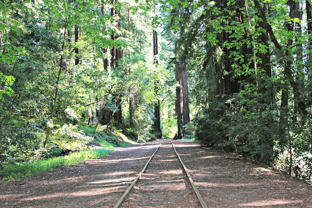
It won’t take you through the park, but the Port Jervis line — accessed via Penn Station from New York City — gets you pretty close to Harriman’s best hiking areas. Bring your pack and stay the night in the park, and get back to Manhattan in time for work on Monday. Picture via Dreaming of Dimples.
New Shuttle Service!
Please note that on weekend mornings only, from July 3 to October 31, a shuttle bus will run from the Metro-North Train Station at Tuxedo, New York, through Harriman State Park. See the details here:
TUXEDO SHUTTLE SERVICE FROM METRO-NORTH TRAIN STATION
From Penn Station to Train Stops on the West Side of Harriman
To catch a ride on the Port Jervis line to any of the stations on the west side of Harriman State Park, take the train from Penn Station to Secaucus Junction, New Jersey — about a ten-minute ride. From Secaucus Junction, transfer to the Port Jervis line, heading north to any of the train stations below.
Train Stations, and the Trails They Serve
Suffern Station:
Access to the Suffern-Bear Mountain trail; taxi service, Shortline bus service back to New York; groceries
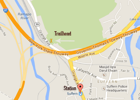
There are plenty of trains stopping at Suffern hourly on the weekends, and more frequently during the week. The earliest arrives at The train station at Suffern is convenient to the start of the Suffern-Bear Mountain trail, a 23.35-mile longitudinal trail that ends at Bear Mountain. Two lean-tos (Stone Memorial and Big Hill) serve tired hikers on this trail, and may be used overnight.
Check the train schedule for the Suffern station before you leave.
You can make a two-day tramp out of this circuit, by taking the train to Suffern, hiking for two days on the Suffern-Bear Mountain trail, and taking the Metro-North at Manitou Station back to Grand Central Terminal. (Note: this is a demanding, up-and-down rollercoaster of a trail, and you shouldn’t attempt to complete it in one day unless you’re very fit).
To reach the Suffern-Bear Mountain trailhead, head northwest on Orange Ave (Route 202) when you leave the station; walk under the New York State Thruway overpass (the road becomes Route 59) for 500 feet and you’ll see the yellow-blazed start of the trail ascending the hill sharply from within a little hollow, to the right.
You may want to try other trails, and in that case the Suffern train station is a good place to disembark. There are a number of taxi services in the Suffern area, and you can arrange a pick-up from the station ahead of your hike.
Sloatsburg Station:
Access to: Powerlinz climbing area and Torne Valley; Dater Mountain, Reeves Visitor Center, trails in Pine Meadow Lake area; Sterlington Station restaurant and deli for sandwiches.
The Sloatsburg station is the closest station to Reeves Meadow Visitor Center, and some beautiful ridge-top hikes and a trail along scenic Stony Brook begin from that parking lot, although you’ll walk almost two miles to reach it.
The trains run at irregular times on the weekends, with the first train arriving in Sloatsburg after 9 am and running in two-hour intervals after that, until evening. Check the train schedule.
From the Sloatsburg station, walk north on the Orange Turnpike/Route 17 to Seven Lakes Drive; turn right onto Seven Lakes Drive and walk another mile. You can stay on this road until you see the Reeves Meadow Visitor Center parking area on the right (you can’t miss it), or, at a quarter-mile past the Thruway you’ll see the red-blazed Pin Meadow trail leave from the right. This is a nicer off-road alternative to Seven Lakes Drive; it will take you to the start of the blue-blazed Seven Hills trail or, just a little bit farther on, to the Visitor Center (which is only open on the weekend and holidays).
There is a network of popular trails in this area — my favorite is the Seven Hills trail — and you can make your hike longer or shorter according to your energy. Make sure you have a map.
For the energetic weekend-long hiker, the beauty of the Sloatsburg station is that it deposits you in a very scenic corner of the park, at the start of so many picturesque trails, and you can combine these trails (both ridge trails and valley trails) to traverse the park in two days, and see all the variety Harriman has to offer in its lakes, streams, and boulder-strewn mountaintops, and overnight in a lean-to.
Or, if you only have one day, you can make an end-to-end hike of the lower part of Harriman by taking the train to Suffern and hiking to the station in Sloatsburg via the Suffern-Bear Mountain trail. You’ll leave the yellow-blazed Suffern-Bear Mountain trail at the Kakiat Trail or Conklin’s Crossing (a good choice if you need a quick dip in Pine Meadow Lake).
Tuxedo Station:
Access to: Ramapo-Dunderberg trail; grocery store/deli; Kakiat and Triangle trails; bus stop.
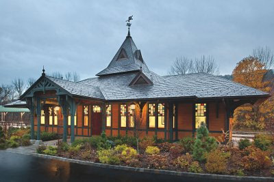
The Tuxedo train station. Follow the red blazes out of the parking area and north, over the Thruway and into a neighborhood, for access to the Ramapo-Dunderberg trail.
The pretty little station at Tuxedo stands close to the start of the Ramapo-Dunderberg Trail, with access to the Kakiat and Tuxedo-Mount Ivy trails. The Ramapo-Dunderberg trail is the oldest and longest trail in the park, and I can’t say it any better than Raymond Torrey said it in 1926, writing in New York Walk Book that the R-D Trail is:
“…more than any but the strongest walkers will care to undertake in one day, there are however numerous cut-offs and connections with other trails which make fine circular trips. The lay-out and scenery are continuously interesting and every walker will want to be acquainted with it.”
You’ll catch the ten-minute train ride from Penn Station to Secaucus Junction, and transfer to the Port Jervis line. Trains on the weekends stop at Tuxedo infrequently, with the earliest arriving at 10:17 am. Check the schedule to see the train times, which are nearly two hours apart on the weekend.
From the train station, follow the red blazes of the Ramapo-Dunderberg trail out of the rail station parking lot and north through a residential neighborhood: over the Ramapo River and New York State Thruway, up East Village Drive and onto Grove Drive, where the trail (finally!) enters the woods to climb Horse Pond Mountain.
If you’re prepared for it, several longer loops are possible. You can complete the Ramapo-Dunderberg trail in its entirety over a weekend (sleeping in one of the four lean-tos that serve hikers on the trail (Tom Jones, Bald Rocks (temporarily closed), Brien Memorial or Fingerboard) along the way.
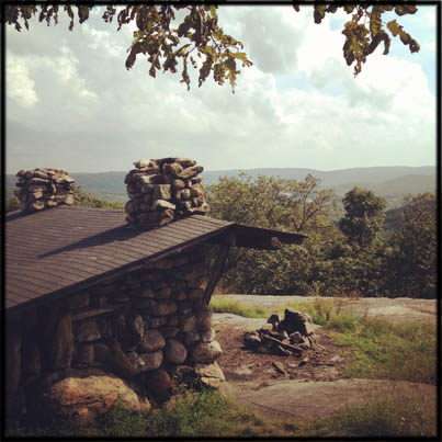 Or, you can make a loop between train stations, finish your hike at any of the other stations on the Port Jervis line. For little-used Harriman Station to the north (see below), you’ll want to reach the Appalachian Trail and follow it west, entering the sliver of Harriman park west of the Thruway to connect to the Sapphire trail. That trail will take you north to the Harriman Station.
At Tuxedo, there’s a decent deli across the street from the train station if you need to stock up. Note on the map, also, where water is available, and if you’re doing a multi-day trek, bring a water filter.
Harriman Station:
Access to: Sapphire Trail, to Appalachian Trail; taxi service from station
Again taking the 10-minute train ride from Penn Station to Secaucus Junction, transfer in Secaucus to the Port Jervis line, and get off at Harriman Station. The earliest train arrives at 10:28 on a weekend morning. There is nowhere in the area to pick up sandwiches or snacks for your trip, so you’ll have to pack everything in advance.
Trains run infrequently to this station (there are seven stops per day on the weekend, in each direction). Check the schedule for accurate times.
Don’t confuse Harriman Station with some kind of main entrance to the park with a visitor center, trail maps, etc. It’s just a train stop, and a small one at that. Want to see how badly this can go if you assume the Harriman Station is a convenient destination? Read this link to a blog post on OneAwkwardYear.com. Hilarious!
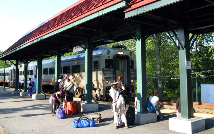
Harriman train station. Picture via Bridge and Tunnel Club.
Harriman Station is not particularly convenient to Harriman State Park. There is basically one trail that leaves from the other side of Route 17: the blue-blazed Sapphire Trail. You’ll need to take this trail for two miles before you reach the nearest intersection with another trail (the Appalachian Trail). Staying on the AT, you can hike east into Harriman by turning left, crossing Route 17 and the New York State Thruway before reaching Elk Pen parking area and the continuation of the AT.
You can also catch the local taxi service from the station. Arrange in advance with Village Coach Taxi.

