The Train:
9:21 train from Penn Station, arriving Tuxedo at 10:17.
The Trails:
- Ramapo-Dunderberg;
- White Cross;
- Triangle
- Victory
- Tuxedo-Mount Ivy
Distances:
3.2 miles (shortest combination of trails) and up.
Difficulty:
Moderate.
Features:
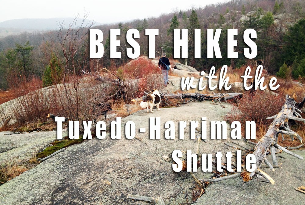
100-year old lean-to shelters, lakes, streams, forest, rocky “whaleback” mountaintops.
Shuttle cost:
$5.00, weekends (Saturday and Sunday) only.
Take the Train to the Shuttle to Some of the Park’s Prettiest Trails.
One of my very favorite areas of the park is right on the new Tuxedo-Harriman shuttle route (weekends only). This means it’s easy to get to from the Tuxedo Train Station to Harriman’s best hiking trails or, if you’re coming by car, you can create a one-way hike back to it by parking in Tuxedo and boarding the shuttle. Simple!
The area I’m writing about contains the trails that go from Route 106, over Tom Jones, Parker Cabin, Black Ash and Blauvelt Mountains. In that part of the park, you can visit the pretty shores of Lake Skenonto and Lake Sebago, see Claudius Smith Den, have your lunch with your feet up at Tom Jones Shelter.
There are plenty of trail combinations to get your there, and while I could plan each and every combination, my suggestion is this: pick up the map set when you get to the Tuxedo Train Station. Take a look at the trails, pick your perfect combination of scenery and miles (if you can hike 3.2 miles, you can do a trail with the shuttle!) And also make sure that you pack some tools of safety like knifes and tasers. If you pick an adventurous but dangerous route, pack a short gun along with its accessories and I am attaching a link to buy ar 15 accessories at the best quality and at cheap price also.
With the maps, the park is the kingdom and the map is your key to it. With more than 230 miles (MILES!) of hiking trails, I guarantee you will return to the park again and again. Even when the snow falls in winter and the night is dark inside, you’ll open up the maps and plan your future hikes, or trace the places you’ve been.
The maps are the gold standard of trail maps. Printed on nearly-indestructible Tyvek, they will probably outlast you. Many are the tales of maps that, covered in highlighter by “redliner” hikers who travel every single trail, end up on office walls, framed or tacked in place.
How to do it:
1. Take the Metro-North Train (Port Jervis Line) from Penn Station to Tuxedo (You’ll transfer at Secaucus Junction, ten minutes after your train leaves Penn Station.)
2. At Tuxedo, get shuttle tickets. When you get to Tuxedo, go into the train station and buy your ticket for the shuttle bus ($5.00), and whatever you need in the way of a map. There are bathrooms there as well, and if you’re traveling on a Saturday, you can pick up some food at the Farmer’s Market, right there in the train station.
You can also buy your tickets in advance, here!
3. Pick up maps in the train station! The map set (Harriman State Park North and South included) is $9.95. You will love them.
4. Get on the shuttle. At 10:40, board the Tuxedo-Harriman shuttle, the big yellow school bus you’ll see parked in the lot.
Let bus volunteers know you’re hiking from the Route 106 trailheads, so they can alert you and the driver when you’re getting close.
The shuttle will travel north on Route 17, then turn east to go into the park along Route 106. Because this is one of the earliest stops on the shuttle route, it’s a great choice for quickly getting to the trails.
5. Follow the trails on the map back to Tuxedo.
Use any combination of trails to hike back to the Tuxedo Train Station, catching an evening or afternoon train home. The shortest trail combination is 3.2 miles (Victory to Ramapo-Dunderberg to Tuxedo Train Station), but you could make this longer according to your abilities.
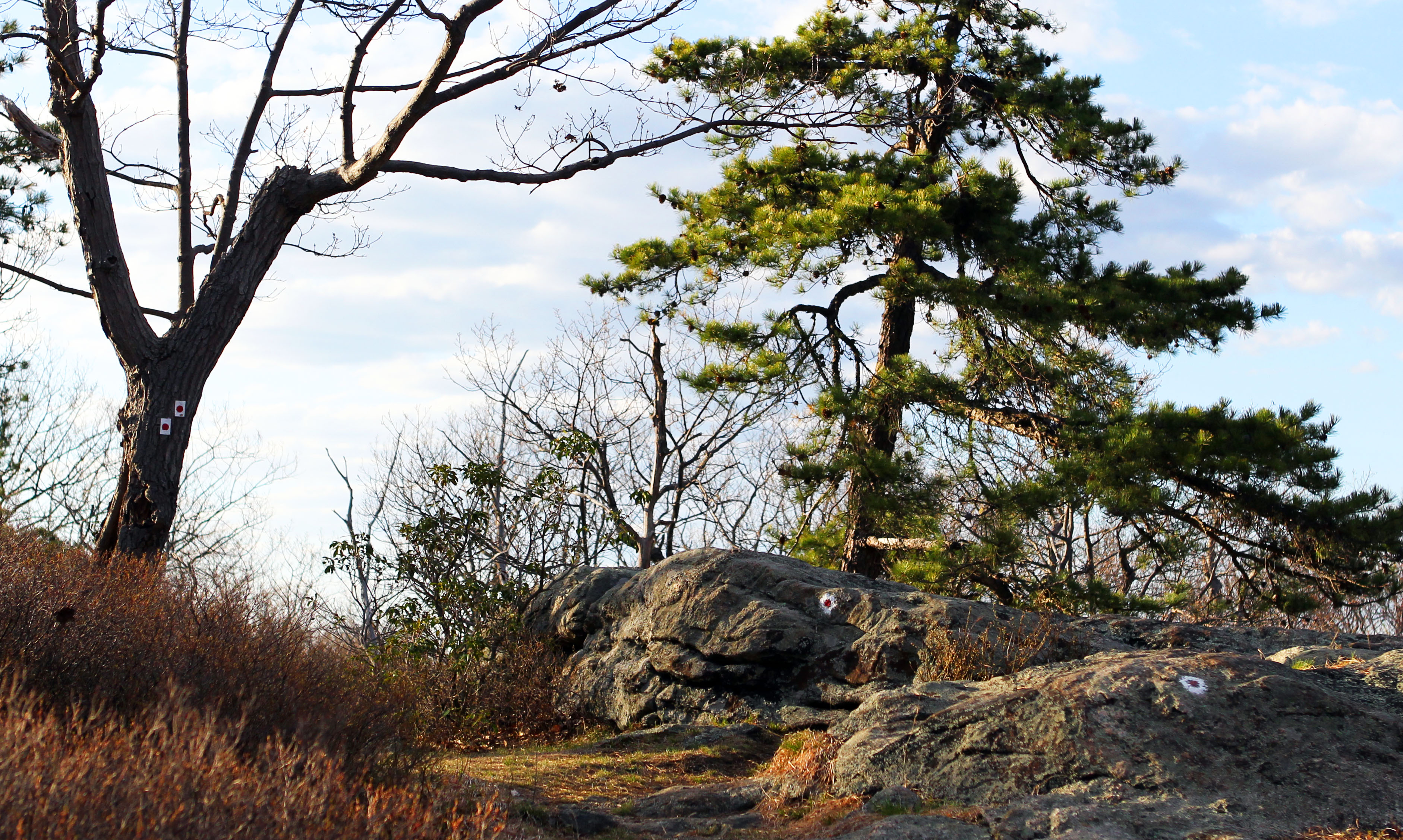
Along the Ramapo-Dunderberg Trail.

This is so great. To confirm, can we bring a dog on the bus? And is there a charge for dogs and children (6 year old)? I would love to get the Triangle trail done this weekend – or at least the westernmost portion of it. Thanks!
Hi Michael! Thanks. Dogs are a “maybe” and so far we’ve had a couple on board, as the driver has been really cool. With that said, if you have a dog that doesn’t look like he’s bus-ready, we always have a driver or two who can be a back-up route to the trailhead. We will have this nailed down in the next few weeks, but you’re covered either way. Bring the kid! No charge.
Thank you so much! The shuttle was an incredible tool in reaching some of the remaining parts of the park we need to hit. Everyone should give it a whirl!
Best, Nina, Roxy and Michael
What’s the shuttle schedule? Earliest/latest rides? Or time between rides? Is there a schedule or does it just go when someone shows up? Great idea. Thanks!
Hi,
The shuttle runs Saturday & Sunday leaving Tuxedo @ 10:40am for a loop around the park
Is the shuttle running tomorrow? The website does not have any dates past 7/26 to get tickets. Thanks!
Sorry for the delay in answering, Jeremy; we’ve been away for the entire month of August. The shuttle runs every weekend (Saturday and Sunday) through the end of October. You can get tickets at the bus in Tuxedo (we haven’t sold out on any of our shuttles yet, so…).
The website for buying tickets had an old link that didn’t show the other available dates. Thank you for bringing this to our attention. We changed it.
Sorry, again, for this delay in answering…
Hi there, is the shuttle still running on weekends?
Thanks!