The Trail Conference recently opened a new section of the Long Path in the Catskills. After reading Avi David Edelson’s article about the building of the newest trail section, I thought I’d drive a little further north — up to Phoenicia — for my next hike.
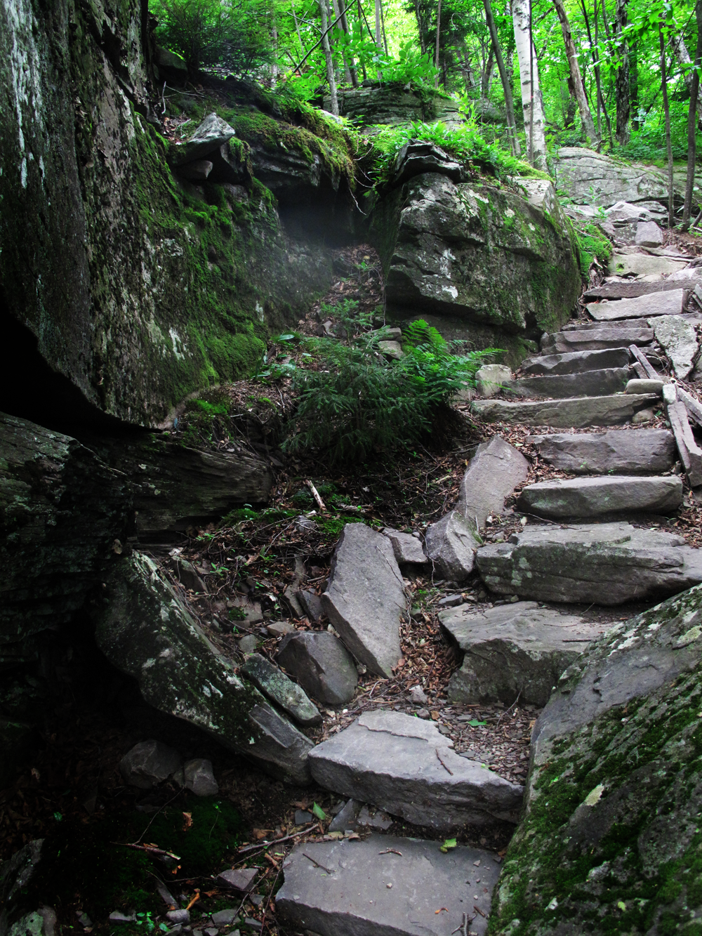
Stone steps, built by volunteers of the New York New Jersey Trail Conference, wind up the slopes of Cross Mountain. The steps are part of the Long Path extension that eliminates more than seven miles of roadwalk in Phoenicia, New York.
ON A PERFECTLY CLOUDLESS AFTERNOON at the end of July, a hint of autumn in the chilly Catskill air, I’m struggling up the rustic stone steps of what I’d call “Jenga Mountain”.
You know the Jenga game: stack little wooden blocks atop each other, and then try to remove them one by one, without the whole pile collapsing, by nudging them out? Well, this is the rocky, many-tonne version of that game, played by giants. Miles from the start of the Long Path’s most recently-completed section, the Trail Conference has made a staircase of the rocks that are strewn abundantly in the shady cliffs of Cross Mountain, in the Slide Mountain Wilderness. The steps, expertly made, wind up, up and out of sight.
All my favorite hiking trails have this in common: a place along the route where you feel as though you’ve stepped through a curtain, where geography has folded under you, and you’re magically in another part of the country. Sometimes it’s just a collection of fir trees at the top of a mountain that reminds me of Colorado, or Newfoundland. Or a mountain stream through a tumble of hemlock root and stone that suggests the Adirondacks.
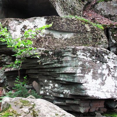
Sand, deposited at the bottom of a delta where the Catskill Mountains now stand, created the “jenga” look of these rocks on the new section of the Long Path in the Slide Mountain Wilderness area.
At the top of these steps is where the Long Path, over the eastern edge of Wittenberg Mountain, becomes that Somewhere Else.  Abruptly, the trail changes from a long wander through a barbed blackberry field, to a deep green hemlock wood, then a forest of old, muscular yellow birch. The trail playfully twists out of sight, around a white boulder, golden roots clasping rock as if they’d come to a friendly arrangement more than a millennium ago.
FINDING PLACES LIKE THESE ARE WHY I HIKE. I wonder if it’s common to hikers, those who can easily convince themselves that the best course of action when thing get too dull is to drop everything, and hike. You never know what might be around the corner, the thinking goes. And if you don’t get a move on, you won’t see it.
The Long Path
As conceived by Vincent Joseph Schaefer in the 1930’s, the Long Path was never really meant to be a deep wilderness experience, but an unmarked route for walkers to scout their own “trail”, linking landmarks and using map and compass — no blazes needed.
But by the 1960s, the Long Path had evolved into something more traditional, and its route wound alternately between public parks and open space, and private land and roadways. Now the trail that starts in Fort Lee beneath the George Washington Bridge joins not just landmarks, but places of scenic wonder, with a single, seemingly audacious idea.
The Palisades escarpment, Harriman and the Ramapos and the Hudson Highlands. The white cliffs and high lakes of the Shawangunks, the Catskill Park, and then into state reforestation lands; the Schoharie Valley, Vroman’s Nose, Mine Kill and the Endless Mountains. And in between wilderness escapes, the Long Path follows roads that tie together the villages along the route, encouraging restaurants, shops, outfitters, Chambers of Commerce and the like to cater to hikers.
The course of such projects is often winding, however, and in its first century, the Long Path lays somewhere in the dark woods between “a great idea” and “a great accomplishment.” Hikers complained on bulletin boards that, to get to those quiet wilderness areas, you had to hike a lot of asphalt, through no-camping areas in populated places.
In addition, relatively few people knew — still don’t know — of its existence; I was surprised recently to learn from Ken Posner’s 2013 article in Backpacking Light that only 120 people have completed it :
The Long Path is virtually unknown. It might as well be a secret, like the blank spot in the middle of a map of unchartered wilderness. When I set out to thru-run it in August 2013, only 120 people had completed the entire trail…This compares to some 14,000 documented completions of the Appalachian Trail.” — Kenneth Posner, Trail Running the Long Path
And indeed, few people — myself included — will ever complete the hike from end to end. But by hiking at least a portion of this impressive project, I wanted to feel connected to the larger adventure. And I wanted to try this new trail.
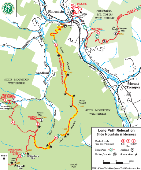
The new extension of the Long Path, showing viewpoints and the campground at Woodland Valley. As far as I can tell, there isn’t a map showing the topography of this new trail yet. (I’m sure it’s coming!)
Start With an Overnight at Woodland Valley State Campground
There were a few reasons to choose the Woodland Valley campground as a place to spend the night before a daylong hike. As a purely practical matter, I liked that the DEC-run campground is sited right on the trail, with the red-blazed Phoenicia-East Branch trail extending right through the day-use parking area.
But besides that, Woodland Valley sits at the high end of a valley road that runs to Phoenicia, and right past the Lane Street trailhead, seven miles to the east. Biking into town, you’ll descend 673 feet over 6.7 miles, and so the perfect loop could be made by a single person, one car and a bike.
You can spend a peaceful night under the stars at the campground, then coast into town for breakfast, backtrack the quarter-mile to the trailhead, and then hike the Long Path back to your car.
I found a spot near the river (the sign at the unmanned campground office window read, “Find a campsite and pay in the morning.”).  The stony Esopus River, low and frisky in the twilight, cradles the classic mountain campsite. Further down the valley it widens out to become a sort of playground for inner-tubers, but up here, it’s barely deep or wide enough to fish. I pitched a tent near my fireplace, boiled coffee on the outside hearth, listened to the softest rain and before I knew it, two hours had passed. Camping casts a spell.
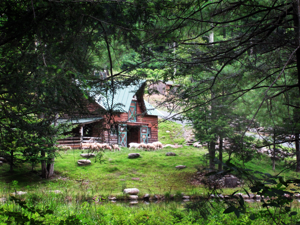
Sheep graze near a rustic barn, set in a hillside pasture, on Woodlands Valley Road in Phoenicia, New York. The road into town alternates between Catskill forest and agriculture, before reaching the suburb-y outskirts of the town.
THE ROAD OUT OF WOODLAND VALLEY CAMPGROUND is lazy at first, and it’s hard to imagine an easier, or prettier, 6-mile bike ride into town. It swings in wide oxbow curves alongside the river, past roadside, bark-sided cabins. In the early morning, a rooster hollered from a sheep paddock of such an Irish green, trimmed level and neat by the animals, that I had to slow, and then stop. Further along, a man waved good-morning from his driveway; a woman bent over her garden to pick a bunch of bee balm and coneflower. I coasted past them, picking up speed now; I coasted over a bridge that spanned the river, coasted without passing another car or truck for the entire descent into the valley, where at the bottom I remembered that my bike had pedals.
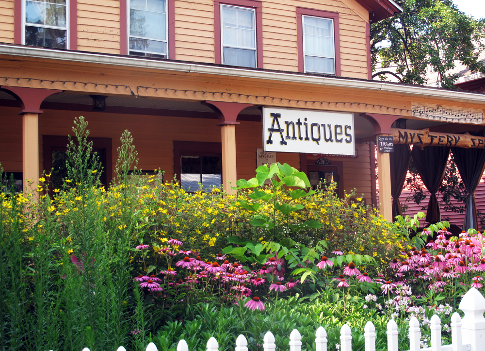
Mystery Spot Antiques, on Main Street in Phoenicia, New York.
PHOENICIA IS HIKES MECCA, a welcoming, gutsy little township with coffee shops, outdoor seating for its cafes, a bike rental/outfitter, and general stores capable of supplying travelers with as much or as little as they may need in the way of food and equipment, making it relatively simple to put together a comfortable day’s outing, or more.
My first, and only, disappointment of this adventure was getting to the highly-recommended breakfast spot, Sweet Sue’s, to find it was closed on Monday and Tuesday. Mama’s Boy Coffee Shop, a colorful clapboard cottage on the corner of Bridge and Main, had limited breakfast options, and starting the day with an egg and cheese bagel, and I couldn’t help but think I was missing something.
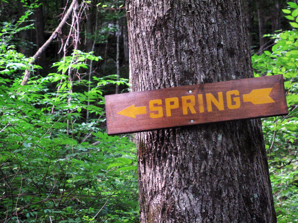
Helpful sign. The trail turns right here (towards fall?). After a rainy day, water ran off the mountains and a hiker would have no problem finding a drink on the way up.
The Trail
The new section is 9.5 miles from the trailhead on Lane Street to red-blazed Wittenberg-Cornell-Slide Trail; it’s another 2.6 miles from there to the day use parking area and campground at Woodland Valley.
The new section starts at the end of Lane Street, a residential dead-end less than a quarter-mile from Main Street Phoenicia. The trail follows an already well-worn footpad benched into a steep hillside, along a series of switchbacks which make climbing the trail a good deal easier than if it had simply charged up the mountainside.
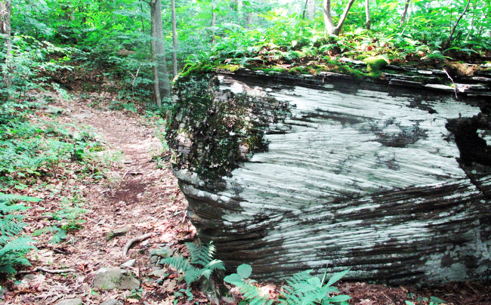
Unlike the Harriman ridges, the tops of Romer and Cross Mountains are snug forests, affording few views of the surrounding peaks and valleys. But this has its charms. The trail is its own reward, winding first through hardwood forests that abruptly yield to dark hemlock forests, or through mini-canyons of stacked sandstone left over from the days when the Catskills were a delta of sandy deposits and dunes.
Underfoot, too, the trail changes, from stony steps on the uphills to the soft, hollow-sounding duff fallen from a fertile, tight forest. Moss, ferns and lichen spring from the tops of white stratified sandstone, an altogether unique sight among trails I’ve hiked in the area.
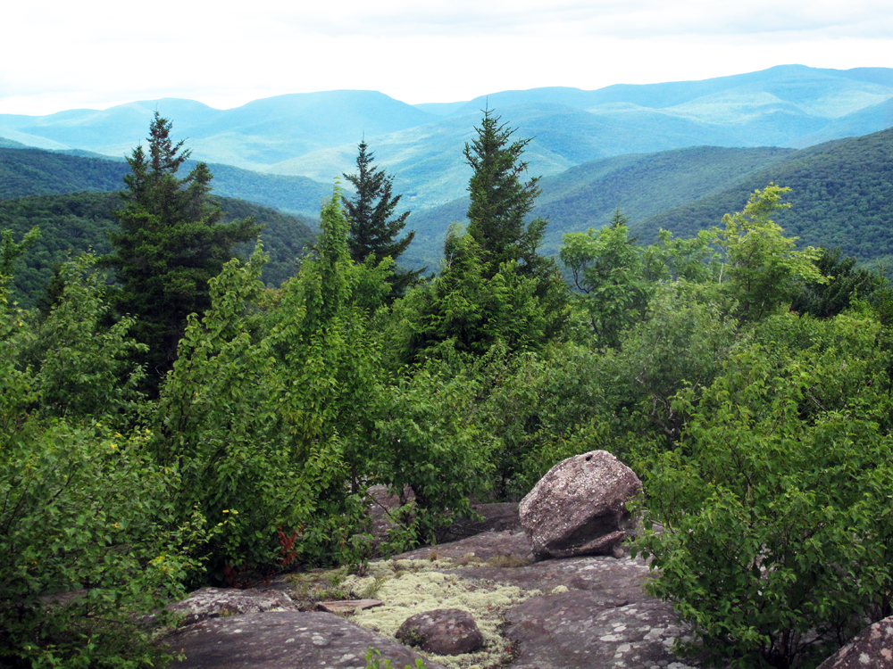
Here and there, breaks in the trees finally show the view over this part of the Catskills. I took my rest between two rude cairns stacked on a cliffside, looking west to Mt. Wittenberg. Further along, a different view stretched east over Samuel’s Point, with the Ashokan Reservoir spreading beyond.
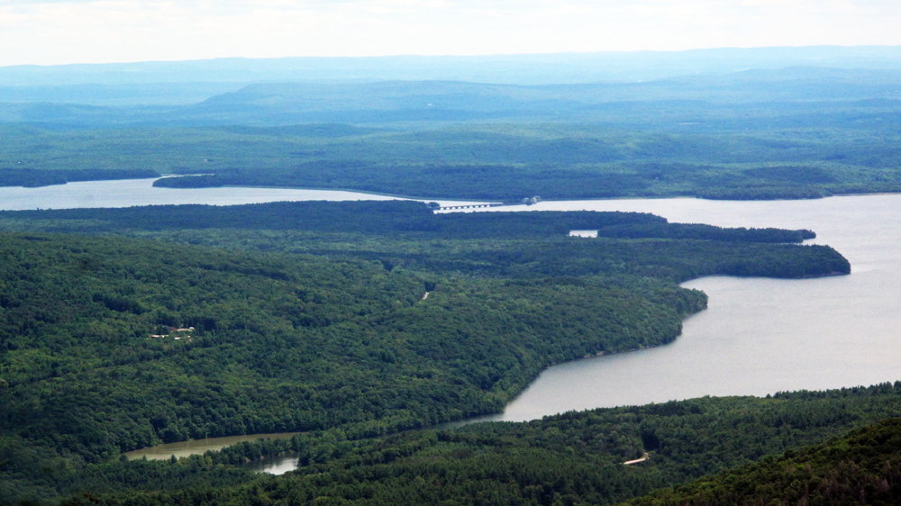
Ashokan Reservoir, with railroad bridge, from the trail.
The new section in the Slide Mountain Wilderness of the Catskills eliminates a 7-mile roadwalk, taking a traveler up three mountain. “Over a hundred volunteers have spent thousands of hours building this trail”, said Trail Conference spokesman Jeff Senterman on its opening, singling out the “amazing examples of trail building work.”
True that. The Trail Conference has created some beautiful treads and stepwork along the Appalachian Trail at Bear Mountain, and I saw some of the same craft, beautifully lavished on these Catskill slopes. Ascents are mollified with level traverses. Nobody went blaze-crazy. A wooden sign indicates free-running water at a spring, and at least one thirsty hiker — me — appreciated the heads-up.
I had no human company, save two trail runners (who are these people?) and another hiker named Ira who caught me up at the wide Ashokan viewpoint. Tuned in more to the sound of approaching bears than other hikers, I jumped at the broken silence.
Of course, you’re never in complete silence on the trail. You only have to close your eyes and listen to become aware of how un-soundless the woods really are. Distant motorcycles, the chitter of birds, crickets in the grass high on the tops, and far-off purr of a jet engine. All along the ridge of Cross Mountain, ruffed grouses fretted in the underbrush, sometimes so suddenly they made me jump.
But once, in those nine-point-five miles, I stopped for a sec to cool my jets. No plane flew overhead. No bird ruffled the understory. Not a trickle or a sigh or a roar or a burp, as far from the paved trail as a body could get. True silence. Just for a minute or two.
The Practical Stuff:
The Trail
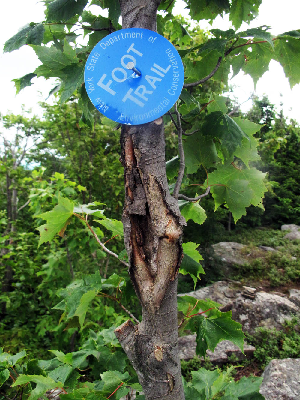
The new section of the Long Path, opened in June, 2014, is a 9.5-mile stretch of trail connecting the village of Phoenicia to the red-blazed Wittenberg-Cornell-Slide Trail, crossing three Catskill mountains: Romer, Cross and Wittenberg.  And it’s a beauty. The trailhead for the new section is at the end of Lane Street, in Phoenicia. It’s blazed regularly with blue DEC “Foot Path” discs, nailed to trees along the route.
Hikers should sign the hikers’ log book, near the trailheads at each end.
Getting There
Follow NY Route 28 west for 23 miles to Phoenicia. Turn right at the first turn to Phoenicia (Bridge Street). Follow Bridge Street to just before the railroad tracks, and turn left onto High Street. Follow High Street and then Woodland Valley Road 6 miles to the Woodland Valley State Campground. It is a 2.75-mile hike from the campground to the Long Path, or a 7-mile bike ride or drive to the trailhead at Lane Street.
Phoenicia, New York, is reached via exit 19 on I-87 (NY State Thruway) north. Follow Route 28 West for 23 into Phoenicia. Turn right(ish) at Bridge Street, leaving Route 28 and entering Phoenicia.
Then, either proceed into town by crossing the bridge, or go to the trailhead by turning left onto High Street, then left onto Lane Street.
Phoenicia
Phoenicia is an old-fashioned blend of restaurants with outdoor seating, antique shops, a general store, and other boutiques with a decidedly local feel. Most of the businesses are concentrated along three blocks on Main Street.
It is generally accepted that the best breakfast in town, with killer pancakes, is at Sweet Sue’s, on Main Street. When Sweet Sue’s is closed, Mama’s Boy coffee shop makes a decent replacement.
For lunch and dinner, Brio’s Pizzeria and Restaurant looked like the place to be, with outdoor seating and crowds for their creative and eclectic menu.
Beware the ATM at the Key Bank, which charges $4.00 for withdrawals if you don’t have a Key Bank account.
Camping:
There are several campgrounds in the area, as well as a lean-to on Terrace Mountain, reached by hiking the yellow blazed trail Terrace Mountain trail from its intersection with the Long Path. I stayed at (and recommend) the Woodland Valley state campground, on Woodland Valley Road. It is run by the State DEC.
Campsites are $20.00 for an overnight stay. You can leave your car at the day area parking area for an additional two dollars (it’s $6.00 if you don’t use their campsite). You will have no problem finding a spot to camp during the summer weekdays. The woman in the office told me the campground is much busier on the weekends, but still doesn’t fill up entirely.
Campsites all include a fireplace and picnic table. “Quiet hours” start at 9:00 pm and are strictly enforced, leading a more peaceful night’s sleep for all. Bears are common in the area and all food MUST be stowed in your car; “A fed bear”, warns the signs posted in the camp, “is a dead bear.”
Getting to the trail by bike:
Ride your bike 6.3 miles from the Woodland Valley campground – downhill all the way – into Phoenicia for breakfast and stocking up for the hike, and then pedal back over the bridge on Bridge Street, making the first right after the bridge, onto High Street. Take the first left you come to (Lane Street), and pedal to the trailhead at the end. There’s no bike rack there, but you can lock your bike to the leg of the kiosk, or any of the trees in the parking area.
You can also drive to the trailhead, and leave your bike locked at the parking area near the campground, returning to your car (via bike) at the end of your hike.
Must-haves, and nice-to-haves:
- Hiking poles, to save your knees;
- Food and water. After a day of rain, there was plenty of water running down the side of the mountain, but you’ll need a supply for hiking the topmost ridge. Bring lots of food.
- Map. As of July 31, there is no downloadable PDF map for the Avenza app on smartphones, and (as far as I know) no trail map with both the trail and topography. But the trail is easily followed, if you use the map from the Trail Conference as shown in this article.
- Bike lock, if you’re pedaling to the trailhead.
- Auxiliary battery power for your cell phone. Try the Pebble Powerstick for a full recharge.
- Glympse app on your smartphone, if you’re hiking alone. This simple app helps a loved one keep an eye on your progress, and know exactly where to locate you if something goes wrong. As a solo hiker, I almost never set out on the trail without first sending my “Glympse” tracker to a friend’s phone.
Camping equipment:
If you’re in New York City, don’t have the gear for either the camping or hiking, but don’t relish the thought of lugging tent and sleeping bag on the subway, do consider renting from Traverse Outfitters. They’re the only outfitter in New York City who will deliver your equipment to your house or apartment if you’re within the five boroughs.
With tents, sleeping bags, packs and pads, renting’s just a matter of call, wait for the drop-off, and hit the road. And if your order’s more than $99.00, delivery is free. (Traverse is running specials on rental and delivery in the month of August, too).
Interested in Hiking the Long Path End-To-End?
Read Kenneth Posner’s comprehensive account of doing just that on his article, Thru Running New York’s Long Path, in Backpacking Light.
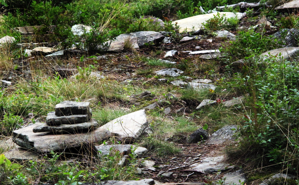
Cairn, Cross Mountain, Catskills.


Hi, could you tell me how long it took you to hike
From trailhead in Phoenicia to Woodland Valley
Campground ? Is there a lot of up and down or is
It mostly ridge walking?
Thanks
Ann
Hi Ann: It took me most of the day. I think it’s about 12 or 13 miles! Not much up and downing, mostly ridge walking. But I’d do it again!
I don’t do too many long hikes (>10 miles a day), so this was a big one for me.
Great write-up! I just took a group the distance of the new LP section today and it’s great! We sell hiking and camping supplies at our store in Phoencia and we also rent bikes. Stop by the next time you’re up. Would love to see more write-ups by you about Catskill trails!
Thanks for the note, Tim — and I’d love to stop by sometime this month to do another post, maybe something about the store, or an itinerary. One of the pleasures of that area is starting the day in town, before hitting the trails. See you soon.
Hi, love your blog. Do any of these trails lead to the AT or should be arrange transportation to get started on the AT near Phoenicia NY?
Debbie…
The AT crosses into Connecticut, from New York, and never gets to the Catskills.
I just did this hike with my 13 year old son. The initial itinerary was more ambitious since we hoped to make the Terrace Mountain lean to for the night. We ended up pitching camp at around mile 8. One feature on the map that we used as landmark, the grand staircase, was as impressive as the name would imply. The trip would be better served as a day hike as the added weight from the backpack was rough on these old knees during the rocky descent to Woodland. Also worth noting was the lack of any water other than the spring close to Lane Street trail head. Next time we’ll shoot for Wittenburg and Cornell!
Hi, great write up! Did you see any areas along the trail that would be good for stealth camping? Any areas to drop down from the ridge to camp if necessary.
Even when you’re trapped in the nation’s most crowded metropolis, backwoods relief is only a short hike down a Long Path.