Need help exploring the trails of Harriman State Park, New York? Download our free PDF map file of all blazed (and some unblazed) hiking trails.
Frustrated with the New York State Parks’ lack of information about legal parking spaces in Harriman State Park, we set out to make a map of our own, and ended up making a map of all the hiking trails (blazed, and some unblazed) in Harriman State Park. You can download this trail map — a free PDF version — here:
Harriman State Park Trails, Shelters and Parking Areas: A Free PDF Map to Download
The map is not topographical, and it doesn’t show fabulous viewpoints (yet), but it is functional as a guide to the enormous network of blazed trails in this wonderful park. Moreover, it shows the GPS location of every legal parking area in the park, as well as some outside the park. And it shows the locations, too, of all nine of Harriman’s lean-tos (maintained and unmaintained).
Read more on our Harriman State Park trail map page.
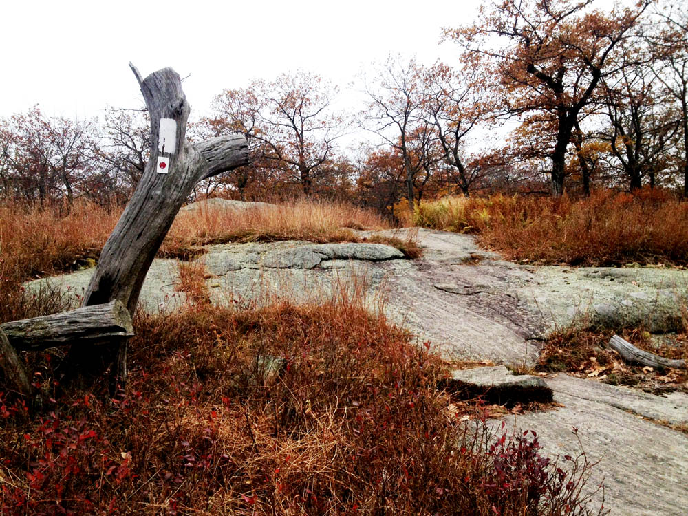
Sometimes trails are blazed on the trees. But in the higher elevations, where glacier-scraped rocks are all you have, you have to look down. A directional arrow on the Appalachian Trail.

Can you please send me a marked map with the trails
Etc. Colored in yellow,blue,red
Harriman maps suitable for use with OruxMaps?
Is there a visitor center where you can ask questions? This is a really big park! Thanks.