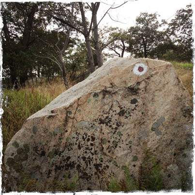
Trail marker on top of Parker Cabin Mountain, on the Ramapo-Dunderberg Trail. Trails are exquisitely marked, mapped, maintained, conceived by the New York New Jersey Trail Conference. ©www.myharriman.com
To find the best hikes in Harriman State Park, don’t rely on trail descriptions alone. Start with the maps.
You can drive through Harriman on your way to somewhere else, and never get the impression that the park is criss-crossed with some beautifully designed, maintained and mapped trails.
But the key to unlocking the trails of Harriman are the maps from the New York – New Jersey Trail Conference.
Really — get the maps.
When you consider that these maps are designed to last forever (remember paper maps that disintegrate? Not!), that you could hike all year in Harriman and still not cover every trail, that they show you (with those cute little stars!) where the prettiest places to hike to are….when you consider this, don’t consider yourself a Harriman Hiker without the maps.
But f You Don’t Have the Maps…
We’ve added some posts to this site that will show you some of the best hikes in Harriman, and you can download our maps for those areas. Here are a few:
West Mountain, and the Timp
Great views may be found along the Timp-Torne and the Ramapo-Dunderberg trails, so a spectacular loop hike can be made with these two favorites. Read our post on West Mountain and The Timp, and download the map.
Overnight “Loop”: Hike the Appalachian Trail, From Your New York Apartment to Harriman, and Back
Sometimes you just want to get away for an overnight hike, but if you live in the city, you might not have access to a car. Here’s our plan: pick up the Shortline Bus from Port Authority Terminal to Southfields, New York, and hop on the Appalachian Trail.
You can hike for two days on the AT, sleeping overnight in one of the historic stone shelters along the way, and after a long second day of hiking, pick up the Metro-North on the other side of Bear Mountain (after you’ve downed a beer at the grand old Bear Mountain Hotel.
Details are set out in our post about this loop hike. Don’t forget to download the map!
Hike the Island Pond Area of Harriman (and download a trail map)
The Island Pond area of Harriman (northern section) is a favorite with stealth campers and “lake baggers”* alike, as you can hike in to lovely, grassy, lakeside campsites and hop in for an unsanctioned swim in beautiful Island Pond. And, not far from Island Pond is the Lemon Squeezer and Fingerboard, one of the Appalachian Trail’s historic stone lean-to shelters — the perfect place to overnight and settle in around a campfire.
Parking is at Elk Pen, off Arden Valley Road in Southfields. This area is also accessible via the Shortline Bus from Port Authority, New York City. Read our post and download the map, here.
Bald Rocks, and Hogencamp Mountain
Wild views only .5 miles in. Rocky ridgelines, interesting forest trails, and a figure-eight that means you won’t be backtracking, except at the very end. A mountaintop memorial. Bowling Rocks.
I love this part of Harriman State Park, for its wildness, its remoteness. Use our map and blog description to put together a hike that combines different trails, and different connectors, for a day out that’s as short or long as you want.
Discover Two Great Stone Shelters, From One Parking Lot (and have some marshmallows with the kids while you’re there)
Two most awesome stone lean-tos are located within “coo-ee!” of each other, and you can reach them by parking in a spot on Route 106, and then choosing whether to go north (Bald Rocks Shelter) or south (Tom Jones Shelter). Take the kids to either of these easily-reached shelters on a chilly afternoon, and have them gather dry sticks for an improptu marshmallow roast-off. They’ll love the adventure, and the views. See (and download) our free PDF trail map for Tom Jones and Bald Rocks Shelter at this link.
Short on Time, But Love Views? Hike to the Top of Long Mountain and Back
Take a quick hike to the top of Long Mountain, and gain wide-open views of Turkey Hill Lake, Bear Mountain and the Popolopen Torne.
Great views. Short hike. This is the perfect hike for days when you want a quick out-and-back with a big impact. See our post on hiking to the summit of Long Mountain, and download the free PDF trail map.
How to Find the Best Hikes in Harriman State Park: Follow the Stars!
Hiking Anthony’s Nose
If you’ve ever driven east across the Bear Mountain Bridge, and seen little figures moving at the top of the hulking mountain above you, then you’ve seen the lookout on Anthony’s Nose.
There are two approaches to the top of the Nose. One leaves from the small, roadside parking pullout along Route 9E, heading north just past the turn for Bear Mountain Bridge (east side of the river). The trail that leaves from slightly north of this spot is a steep climb at first, and isn’t an advisable route to the top during the winter if ice and snow are present.
The other approach is from the south, and there are two good-size parking areas to accommodate you.
Read our post on hiking Anthony’s Nose for full information about this hike.
This page was last updated on June 1, 2014.

