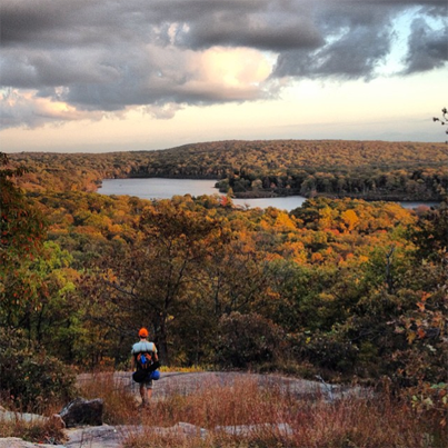
Photo in Harriman State Park by Instagram user #woomas (http://instagram.com/woomas)
The official New York State Park site for Harriman State Park has zero information when it comes to hiking trails. If you are looking for a firewood map, the New York State Parks website for Harriman is a big help. But if it’s trail maps you need, you’ll be looking elsewhere!
Recently, we’ve made the decision to remove free, downloadable maps from this website, and here’s why:
- They’ll never hold a candle to the Trail Conference maps which, when you see them, are a real bargain for what you get. I’m talking about the Tyvek maps AND the downloadable smartphone maps.
- Sale of the maps supports the work of the Trail Conference, without whom these trails would have long ago faded into the forest.
- Sale of the maps also acts as a de facto cost of admission to Harriman State Park, which otherwise charges nothing. So think of it this way: for a fraction of what you’d pay to park your car in New York City, you get lifetime admission to the park, with a souvenir map to keep forever. And you won’t get lost!
So, if you’re looking for a reliable trail map, you have a few choices. You can buy the Trail Conference trail maps in person, by going to any of several locations, though you should call first to make sure they’re stocked with the maps. Some of these retailers are:
- Most area REI, EMS, LL Bean, Dicks, and Campmoor outdoor retailers;
- The Reeves Meadow Visitor Center, Visitor Center and Bookstore, and Bear Mountain — all of these are located within Harriman State Park. Note that the Reeves Meadow Visitor Center is only open on the weekend, and that it’s likely you’ll be charged $8.00 to park at Bear Mountain during the season to purchase your map at the desk!
- The main desk at the Tuxedo Park Public Library, across from the Tuxedo Train Station;
- Garrison Cafe, in Garrison;
- The Frank L. Lautenberg Visitor Center at Sterling Forest State Park
116 Old Forge Road, Tuxedo, NY 10987
Phone : 845-351-5907
Hours: 8:00 a.m.- 4:30 p.m., daily -
NY-NJTC headquarters in Mahwh, New Jersey.
- Sometimes the maps are available from the Lakes Tiorati and Welch offices, but remember you may be charged for parking to leave your car to buy a map!
You can also order your maps online and have them mailed to your household. They’re on Amazon, where you’ll pay less than 10 bucks. You can buy them directly from the Trail Conference website. (and if you’re a member of the Conference, you’ll pay less than the Amazon price).
- You can check out OpenStreetMap for Harriman (and other areas) online. OpenStreetMap is built by a community of mappers that contribute and maintain data about roads, trails, cafés, railway stations, and much more, all over the world. You can contribute to make these maps better in Harriman State Park. For now, though, and until the OpenStreetMap maps for Harriman are better, I encourage you to either purchase the Trail Conference maps, or get out there and add to the OpenStreetMap knowledge of Harriman.
BEST OF ALL: Download the Digital Maps for Your Smartphone, and Never Get Lost!
The trails of Harriman are cofusing, and the distances between intersections can be long. It’s discouraging to be out in the park, holding tight to a map, and not knowing where the blank you are.
That’s why I HIGHLY recommend the Trail Conference’s download-able PDF maps, for use with your Iphone or Adroid. Why? Because they’ll show you exactly where you are on the trail. Sooo handy. And, in case you’ve forgotten your hard-copy maps and you’re already at the trail, you can download them on the spot, in many areas of the park that have decent cell phone reception.
This article gives you directions for using these downloadable maps with the Avenza app (free PDF reader).
Indestructible. Complete and comprehensive. May I say beautiful? The first set I owned was purchased in the dead of winter when I was unable to hike because of the snow. I spent several weeks poring over these maps, hiking them in my mind. I couldn’t wait to get out there.
Remember, when you purchase these maps, you’re also supporting the work that the Trail Conference does to keep the trails maintained and hikeable.
The Island Pond Area. This area offers lots of options for trails of different lengths, a gorgeous lake/pond, stealth camping areas and a stone lean-to.
West Mountain, and the Timp. One of my favorite hiking areas in all of Harriman, for its views, variety, rocky stretches and, of course, West Mountain Shelter and views from the Timp.
Hogencamp Mountain: Boulder-strewn stretches of hilltop spines along the Ramapo-Dunderberg trail make this area an outstanding destination, especially for fall foliage.
Two Shelters, one Parking Spot Want to spend the night? Try either of these two stone shelters by parking along 106.
Hike to Lake Stahahe High Peak and surrounding area with this PDF map: Stahahe High Peak, and read our blog entry about a quick hike in to this perfect fall foliage vista.
Another downloadable PDF trail map for the Tom Jones Mountain area, off Route 106: Another map of the Tom Jones Mountain area
Topo Maps
If you want good topo maps of Harriman, check out Hudson Valley Orienteering clubs maps. Every trail, but also every cliff and boulder as well as the density of the vegetation and the contour data. See http://hvo.us.orient…ent/pid=12.html or http://hvo.us.orient…2.html#woc_maps for lists of what Hudson Valley Orienteering offers.
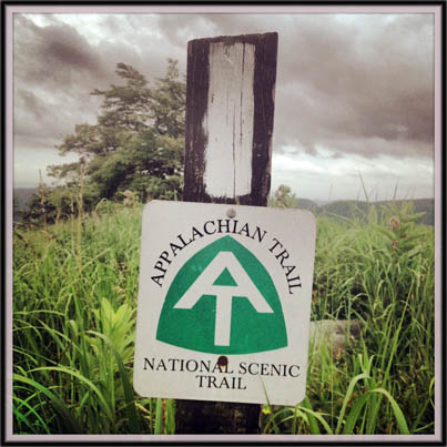
Appalachian Trail marker at the top of Bear Mountain, Bear Mountain State Park. ©www.myharriman.com

