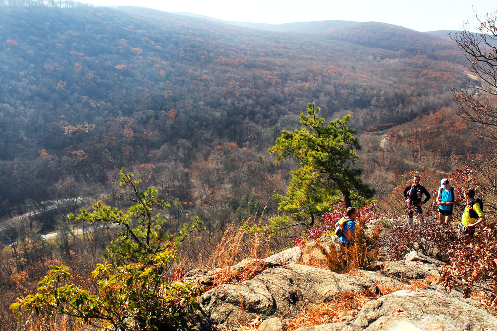
View from Pyngyp Mountain, looking west toward Flaggy Meadow Mountain in Harriman State Park. The Suffern-Bear Mountain trail takes in Pyngyp as it approaches the northern part of the park, and Bear Mountain State Park. This part of the trail involves a steep rock scramble up a cliffside, and is not good for four-legged hikers. More about the First Annual Irishman’s Suffern to Bear Mountain Run in a later post! ©www.myharriman.com
Yesterday dawned clear and unseasonably warm as we climbed to the top of Pyngyp Mountain, on the Suffern-Bear Mountain trail, in Harriman State Park. (It would be a few hours before the first of the trail runners of the Irishman’s Suffern to Bear Mountain Run came through, and the top of the Pyngyp seemed as good a spot as any to wait for them.)
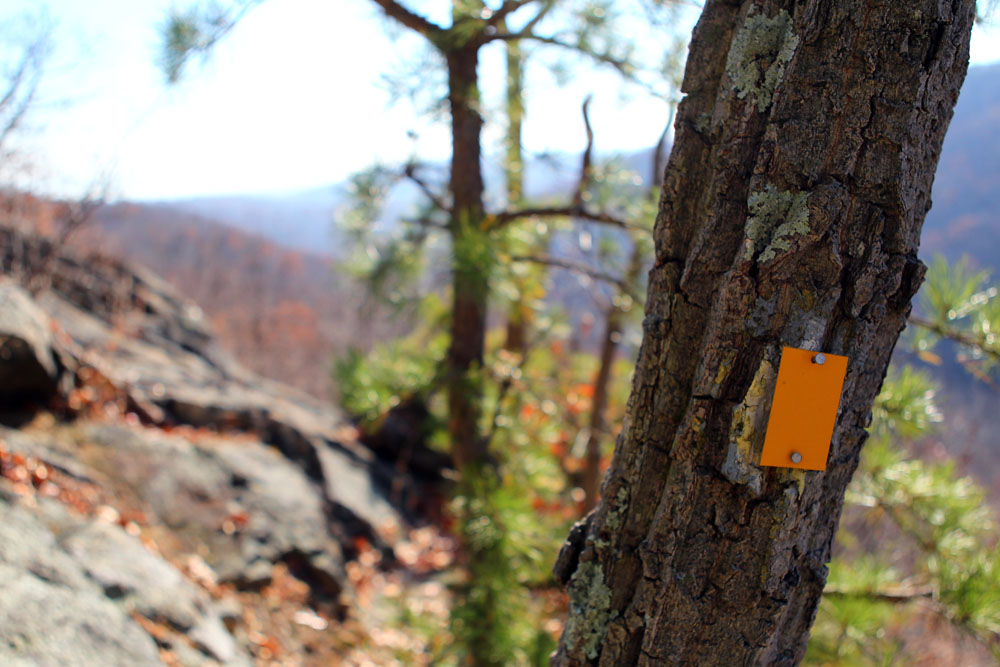
The yellow-blazed Suffern-Bear Mountain trail at the top of the Pyngyp. @www.myharriman.com
With only a couple weeks left to take advantage of the parking along Tiorati Brook Road — the road closes December 1 — we left the car in the pull-out lot and walked the breathtakingly-quiet, car-less road to the trailhead. (You can download our simple trail map for this section of Harriman State Park (see link below), or use the Harriman Park map set, Northern section.)
With the Parkway at its feet, Pyngyp Mountain stands near the eastern edge of Harriman State Park, south of West Mountain and the Timp. With views over the treetops and the mostly-hidden road, Pyngyp faces the Hudson River as it divides distant Hook Mountain and the Palisades from Westchester County to the east.
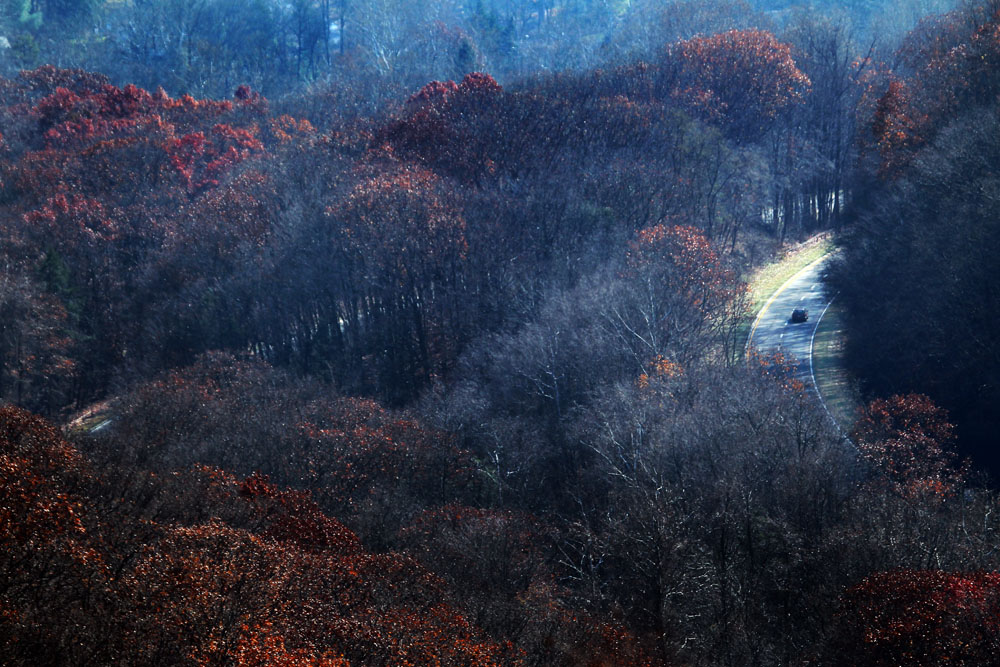
The Palisades Parkway is visible from the Suffern-Bear Mountain Trail as you ascend Pyngyp Mountain in Harriman State Park. But only just. ©www.myharriman.com
The views are outstanding, but it’s the cliff scramble, the pitch pines tilting out over many rocky drops, and the sandy, parched trail underfoot as it skirts glacier-scraped mountaintop outcroppings that give this hike a western feel, something I love.
The trail up the Pyngyp is the result of devious trailblazers who, in 1927, completed a route designed to take in Harriman’s most rugged rock country. Raymond Torrey, in his ’27 article about the Suffern-Bear Mountain trail in The New York Times, lavishes a single-sentence description on this unique part of the route: “The trail climbs up the steep, pine clad cliffs of Pyngyp, for more fine views.”
Download a trail map PDF for the Pyngyp area of Harriman State Park.
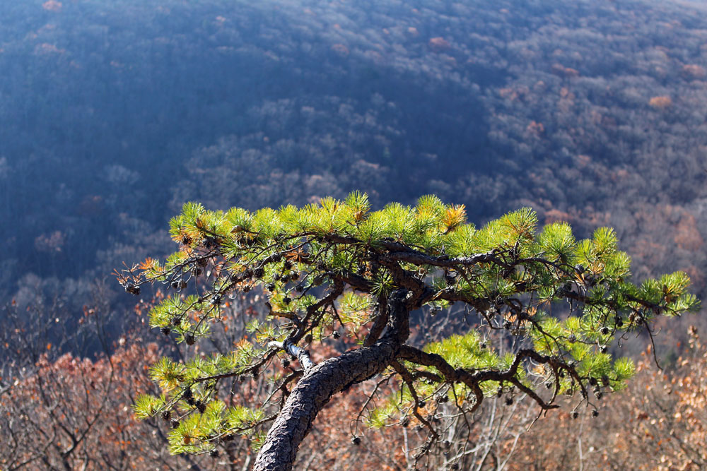
A pitch pine leans out over a Pyngyp Mountain precipice. ©www.myharriman.com
Enter the trail from the Palisades (dodge the cars), and you’ll get it. Climbing the Pyngyp requires a great deal of rock scrambling and hoisting, and it is especially challenging if you’re short in stature. You’ll be glad you left your dog at home.
The Suffern-Bear Mountain trail, once it tops out at the first viewpoint on Pyngyp, curves around to the north for even more views toward the Hudson, and a summit topped with long alpine grasses and more pines, rocks perfectly placed for an afternoon lunch.
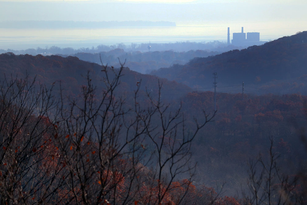
View to the Hudson River from Pyngyp Mountain, Harriman State Park, New York. But what’s that structure? ©www.myharriman.com
Notes:
- The pull-out parking area for this hike has been moved along a re-graded road. It’s still on Tiorati Brook Road, but it’s a little further along. The GPS location for the new parking area is 41 15.153, -74 3.365. You can reach this parking area by taking exit 16 off the Palisades Parkway, and keeping right for Tiorati Brook Road. Remember, it’s closed after December 1.
- In autumn, downed leathery oak leaves make this climb more dangerous. Be prepared to slow down and clear the leaves off the ledges before you put your hands and feet on them. Bring trekking poles for the trail once past the rock scramble.
- Don’t bring the dog unless he’ll fit in your backpack. Four-leggers will find the verticals almost impossible. It’s also not a good hike for children. They could probably do it, but their parents would freak.
- The unmaintained trails and woods roads that lead back to the parking area are difficult to follow, especially now that the leaves are down and obscuring the track. Stay on the blazed trails; don’t bail off the Suffern-Bear Mountain trail using the unblazed routes, unless you are confident in your ability to make it back through some pretty confusing country. They peter out. A better (though longer) route would be to take the Suffern-Bear Moutain trail to the red-blazed Red Cross trail, following this to the blue-blazed Beech Trail back to Tiorati Brook Road — about a six-mile loop.
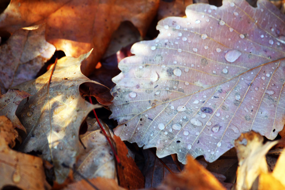
Another reason they call it “Fall”: You can really slip around on the leathery, slippery oak leaves that hide the rocky contours of the trail. Be extra careful climbing the Pyngyp in Harriman State Park, New York; wipe away fallen oak leaves from rocky ledges before you climb them, and use trekking poles on the trails. ©www.myharriman.com
Download a trail map PDF for the Pyngyp area of Harriman State Park.

Why we run on trails.
Dylan Abrons Armajani shares a short video from the First Annual Irishman’s Suffern to Bear Mountain Trail Run.
https://www.facebook.com/photo.php?v=657482927116&set=vb.33500116&type=2&theater
For more information about this Trail Run on 11/16 click here: http://www.rocklandroadrunners.org/index.php/2013/10/suffern-to-bear-mountain-trail-run/
that structure is the Bowline Point power plant in Haverstraw.
Thanks for that!
Looks like a great view? Are there any spots at or near the peak to set up a small tent for the night?